Explore Off The Beaten Track Merabu Village
The Merabu Village located in Kelay District, Berau Regency, East Kalimantan, is not just a settlement of the Dayak Lebo people, but also the last guardians of the Sangkulirang – Mangkalihat, the largest karst ecosystem in Kalimantan, covering an area of approximately 1,867,676 hectares. This karst ecosystem, nominated for UNESCO Global Geoparks in 2016, spans two administrative regions: Berau and East Kutai.
The Dayak Lebo people who inhabit at Merabu Village, part of the Dayak Basap, which is a subgroup of the Dayak Punan—one of the largest Dayak ethnic groups in Kalimantan—are known as hunters (of animals) and traditional medicine gatherers. In the modern era, the people of Merabu generally subsist by hunting for swallows’ nests in the caves abundantly scattered throughout the Merabu forest.
Various interest of Merabu Village:
BLOYOT CAVE - PREHISTORIC ROCK PAINTINGS
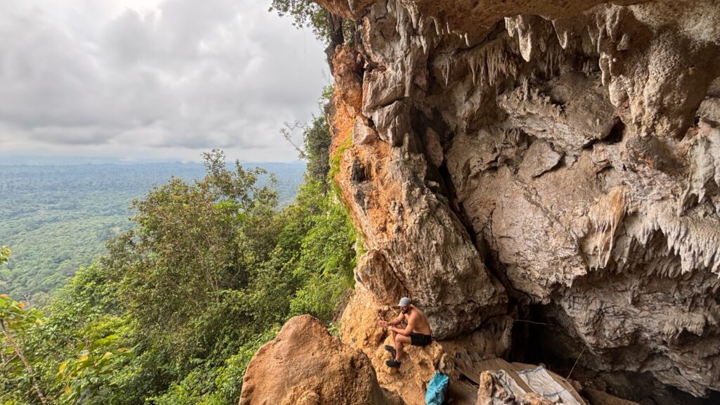
Bloyot Cave has been designated a cultural heritage site under the management of the East Kalimantan Cultural Heritage Preservation Center (BPCB). This cave is one of at least 40 lateral and vertical caves with no less than 1,975 prehistoric rock paintings.
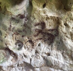
Some of the iconic paintings on the main wall of Bloyot Cave include a rock painting depicting five fingers painted in their entirety in a predominantly dark red color, extending to the carpal area—the wrist. Not only hands, but also fauna paintings, including pigs and geckos, are depicted with three pointed fingers.
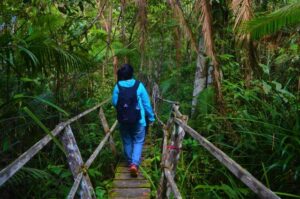
Reach Beloyot Cave by walk around four kilometers from the village over relatively flat terrain amidst the Kalimantan wilderness. Occasionally, you can hear the cries of gibbons, orangutans, and bears endemic to Kalimantan, calling out from afar. Approaching Bloyot Cave, the trail becomes steep, traversing rocky terrain and entering dark cave passages. Headlamps and helmets are essential for safety.
NYADENG LAKE – THE TURQUOISE LAKE
The Nyadeng Lake contrasts sharply with the dense tropical rainforest typical of Kalimantan surrounding it. Covering an area of approximately a quarter hectare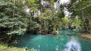 , the lake’s deepest point is estimated to reach 40 meters. Therefore, only those with proven swimming skills are permitted to enter the lake.
The lake, situated at an elevation of 117 meters above sea level, flows crystal clear into tributaries and serves as a source of drinking water for residents. The towering karst cliffs surrounding the Nyadeng area add to its allure.
There are some facilities, including wooden huts with two public toilet stalls and a simple kitchen area for cooking. Another striking feature is the wooden house attached to an ironwood tree. During the rainy season, the lake overflows onto land, so it’s recommended to spend the night in the wooden huts rather than pitching a tent. Don’t forget to pack a sleeping bag and mosquito repellent for a comfortable rest.
KETEPU PEAK
Ketepu Peak is located at an elevation of 393 meters above sea level. While it may seem short at first glance, reaching Ketepu Peak requires a significant effort. Like Bloyot Cave, the journey to Ketepu Peak requires extra physical effort. The hiking trail is very steep, even though the distance is “only” 500 meters. You must be careful of sharp karst rocks, so special trekking shoes are recommended.
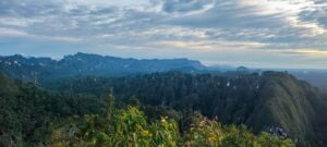
Ketepu Peak is not the highest in the Sangkulirang-Mangkalihat karst ecosystem. However, it is the most accessible for tourist activities. From the relatively small summit, thin, cotton-like mist forms clouds that float low in the forest canopy. Other karst peaks are also visible, even higher in the surrounding area. The morning panorama is usually accompanied by the echoing cries of Kalimantan gibbons.
Combination of Merabu trip
- Explore Merabu Village : 4 Days & 3 Nights
- Merabu Village & Kutai National Park : 7 Days & 6 Nights